 Below are continuing updates tracking the severe weather battering parts of the Midwest. A round of severe weather which included tornadoes, heavy winds and baseball-sized hail has passed through Oklahoma, Nebraska and Kansas. The area at risk stretches from Texas to Minnesota. All times are Central Standard.
9 p.m. (CST): A National Weather Service report states a very large and destructive tornado is likely moving through Fellsburg, Kan. The advisory urges residents to take life-saving precautions immediately.
7:29 p.m. (CST): Tornadoes touched down in Oklahoma, Nebraska and Kansas with no deaths reported and damage in mostly unpopulated areas, Reuters reports. However, according to a National Weather Service advisory: "Conditions will remain favorable for strong to violent and possibly long-lived tornadoes into the overnight hours."
The advisory noted that "Tornadoes during the overnight hours can be particularly dangerous because they are usually fast-moving and obscured by rain and darkness."
The National Weather Service said severe storms were also possible tonight from Texas to Iowa to South Dakota and Minnesota.
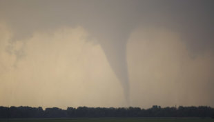
 A tornado forms and touches down north of Soloman, Kan., Saturday, April 14, 2012. (AP Photo/Orlin Wagner)
5:05 p.m. (CST): Tornado Watch issued until 12 a.m. for central Iowa and northern Missouri includes Des Moines.
4:29 p.m. (CST): McConnell Air Force Base near Wichita is relocating some of its aircraft as the severe storm approaches the area, a spokeswoman tells the Wichita Eagle newspaper.
3:53 p.m. (CST): An official in Burdett, Kan.tells KSN-TV a tornado came close, but did not hit the town.
3:32 p.m. (CST): Tornado warnings and initial reports are picking up rapidly. The National Weather Service has 8 preliminary reports and warnings now stretch to Oklahoma.
3:19 p.m. (CST): The severe to strong weather is expected to affect parts of the central and southern Plains this afternoon and tonight, says the National Weather Service. The NWS Storm Prediction Center is forecasting the development of strong to violent long-track tornadoes in parts of Kansas, Oklahoma and Nebraska.
2:16 p.m. (CST): The National Weather Service in Dodge City, Kan. has confirmed a tornado 8 miles northwest of Spearville, Kan.
2:15 p.m. (CST): Baseball-sized hail crashed through windows in northeast Nebraska and at least three possible tornadoes have been reported in parts of Oklahoma, according to an AP report.
1:50 p.m. (CST): The University of Nebraska cancelled their Spring scrimmage as hail and sharp lightning moved through the area 90 minutes before the scheduled kickoff. The Associated Press reports officials decided to cancel rather than delay the scrimmage because of the threat of more strong storms and possible tornadoes later in the day.
1:04 p.m. (CST): The National Weather Service in Hastings has issued tornado warnings in North Central Kansas. Warnings are for Northwestern Osborne County and Southern Smith County.
>> RELATED: A photo gallery of storms in the Midwest Friday.
1 p.m. (CST): The major storms are expected to hit between noon and mid-evening, according to the National Weather Service.
